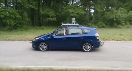
MIT’s self-driving car is a huge step for drivers in rural areas

Autonomous vehicle makers like Google’s Waymo and Uber often demonstrate how capably self-driving cars operate on well-mapped, clearly labeled streets. But what about people who don’t live in cities or suburbs, or who rarely drive on a highway?
MIT now has a solution for those folks.
In a new project out of MIT’s Computer Science and Artificial Intelligence Lab, researchers have developed a method for cars to drive themselves on roads that don’t offer many visual clues like signs, lanes or streetlights. MIT’s MapLite project offers a fix: GPS information from sites like Open Street Maps and a crowdsourced topological map combined with what the team calls a “local perception system.” This system is bolstered by standard driverless car tech like lidar (radar that utilizes lasers), which helps the car see and make sense of its surroundings.
The result has been captured on video, which shows a vehicle traveling down an unmarked road.
Bringing autonomous vehicles to densely populated urban areas could greatly affect people in places like New York City or Los Angeles. But, as the MIT paper pointed out, 65% of roads don’t provide proper lane markings, and more than a third of U.S. roads aren’t paved. Nevertheless, people living in rural areas shouldn’t be left out of the future envisioned by many driverless carmakers — one where the elderly and visually impaired can get behind the wheel and where drunk driving accidents are largely obsolete.
It remains to be seen whether MIT’s findings can help autonomous driving companies make better cars overall. For now, even though the car drives slowly, MIT’s rural road solution offers a start to driving on less public roads. Perhaps traveling at 30 mph or above will arrive in v2.0.