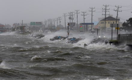
Tropical Storm Matthew 2016: Possible hurricane headed for Caribbean, US East Coast

Tropical Storm Matthew, the 13th named storm of the 2016 Atlantic hurricane season, is likely to evolve into a full-fledged hurricane which will hit the Carribbean and parts of the eastern U.S. sometime next week, the Weather Channel reported on Wednesday.
The National Hurricane Center expects the storm system to reach winds of at least 74 mph, thus qualifying it as a hurricane, in the central Carribbean by Friday, according to USA Today. The storm has already passed by Barbados and is scheduled to pass by Saint Vincent and the Grenadines later in the day, with wind speeds of 60 mph already recorded.
"Short-term rain, wind and sea impacts over the Caribbean will depend on how quickly the storm strengthens," Accuweather wrote. "Breezes will evolve into stiff winds, seas will turn rough and spotty showers will transition to gusty squalls and potentially into severe thunderstorms as the system moves westward over the Caribbean."
By the weekend through Monday, Matthew will have likely affected Aruba, northern Venezuela, Columbia, and "perhaps" Jamaica and Cuba, Accuweather added. Depending on various weather conditions, the storm may be pulled north into the Gulf of Mexico and this would affect Southeastern U.S. states bordering it, though Accuweather Hurricane Expert Dan Kottlowski noted "the track and strength of Matthew beyond four days is highly uncertain."
Other hurricane experts agreed the eventual strength of the storm system, if it does hit the Southeastern U.S., is currently too far off to predict.
"It's too early to speculate on what impact it may have on Florida," NHC senior hurricane specialist Jack Beven told the Sun Sentinel. "It is a possibility, but more than that, we can't say that at the moment."