Scientists want to make a 3D scan of the Earth before we totally ruin it

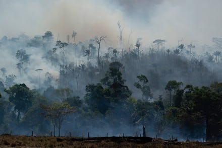
Humans are just scratching the surface of understanding the Earth better, but our time with the planet as we know it is growing shorter. Climate change is altering the Earth's landscape at a rate faster than some people have predicted. And there are scientists who are now worried that we don't have enough time to learn more about the past and present history of our home.
There are still ancient cities hidden deep in the forests that we've yet to discover, and even more archaeological sites of interest to be investigated. All that could be lost if the surrounding environment is ruined.
The loss of that knowledge is what The Earth Archive wants to prevent. The project is led by two researchers from Colorado State University who want to create a 3D map of the world. They believe it's possible to use laser scanning technology, known as 'lidar,' to quickly uncover the planet's secrets and preserve the most vulnerable regions of the Earth in images. This same technology was used in 2018 to uncover Mayan structures that were embedded within a thick rainforest.
One of the leading researchers for The Earth Archive, archaeologist Chris Fisher, was part of that team. According to Live Science, he believed that using scanning technology "revealed more details about the city's ruins in 10 minutes than he and his colleagues could have found in 10 years of research on the ground." It inspired him to campaign to do the same for the rest of the Earth's surface, beginning with at-risk areas like the Amazon rainforest and the diminishing coastal regions.
Critics believe any money and time spent on this project could be better used on different research. This project, as ambitious as it is, could end up diverting funding away from other scientists, they worry. Furthermore, using the lidar requires permission from local governments to fly and use.
“Who is going to give them permission to fly over Brazil?" asked Professor Mat Disney to The Guardian. "The Brazilian government aren’t."
The Brazilian president, Jair Bolsonaro, has been notably hostile against accusations of ignoring climate change and bolstering the deforestation of the Amazon. In addition to facing resistant governments, the 3D modeling project will also take a lot of money and time. Fisher estimates it will cost about $15 million just to scan the Amazon forest alone. And it could take decades to finish mapping the other land areas of the Earth.
With global warming accelerating changes within years, this could mean the project might be outdated by the time the researchers have enough funding and permission to scan a location. Still, the scientists behind The Earth Project believe this is an effort worth attempting.
"I won’t live long enough to see the results of this project," said Fisher. But it's not about obtaining immediate results. "[This is] the ultimate gift we can give to future generations."