This FEMA map will show how at-risk your city is for a natural disaster

No part of our planet will be unaffected by climate change, but some areas will feel the effects of the extreme weather events that accompany that change sooner than others. The Federal Emergency Management Agency recently published its first National Risk Index, a multi-year project which assesses each of the country's 3,006 counties’ potential vulnerability to natural disasters. Unfortunately for Angelenos, Los Angeles County ranked at the very top of the list.
FEMA's assessments account for the likelihood that a county will be struck by any of 18 different kinds of natural disasters, ranging from hurricanes, floods, or tornadoes, to the less common but quite destructive volcanic eruptions. It also accounts for mitigation plans that cities and municipalities have in place to prepare for such disasters and manage the aftermath should one strike. Using that information, FEMA calculates the probability of a disaster, the expected annual loss that it could cause, and the size of the population that would be exposed to such risks. The result is a scale from 0 to 100 that scores the level of risk faced by each county.
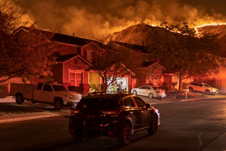
Los Angeles County managed to do everything but go for extra credit. LA scored a perfect 100 out of 100 on the National Risk Index. The reason for the stratospheric risk level is rather evident: it's a major population center that is home to more than 10 million people and has a property value of nearly $1 trillion. Any time a natural disaster comes through the county's borders, it's going to do significant damage. And the disasters do come. Los Angeles County suffered one of the worst wildfires on record in 2020, which ended up destroying 115,796 acres of land and dozens of buildings. But it's not just fires that affect the area. Coastal flooding, droughts, heatwaves, and even the potential for earthquakes make the county the highest risk area in the country when it comes to extreme weather.
While it carries the most risk, Los Angeles County isn't the only major coastal metropolitan area with a lot to worry about. Bronx County, New York and New York County, New York, which encompass two of New York City's five boroughs, rank second and third respectively on FEMA's list. New York City actually has four of the top 11 most at-risk counties, with Queens County ranking sixth and Kings County ranking 11th.
The risk of coastal flooding and destructive winter weather boosts these places, but there is one unexpected threat that FEMA has factored in: tornadoes. While they aren't a common occurrence, New York City does get hit by the occasional tornado and the damage can be significant. Last year, the city experienced a tornado warning, though a twister never materialized. FEMA views that risk, along with the lack of mitigation plans to address it, as substantial, as the condensed population of the big city and tons of buildings means even a small tornado could do major damage.
Other major population centers led the way in rounding out FEMA's list of most at-risk counties, with Miami-Dade County in Florida, Philadelphia County in Pennsylvania, Texas's Dallas County, and Missouri's St. Louis County all placed in the top 10.
If you're curious about where your city falls on the list, FEMA has made a handy map tool that allows you to find your county and see its risk level.